
Watching Toronto grow, 1900-2002
This video uses building construction dates to map Toronto’s rapidly-expanding urban footprint in the twentieth century. It was developed from a set of maps prepared by the City of Toronto’s Patricia Morphet in 2003, and originally came to my attention thanks to urban geographer Ted Relph, who wrote about it in Toronto Transforms (2014). Recently it was brought back to mind by a twitter discussion with Igor Dragovic and a few other Toronto urbanists. This kind of detailed, visually appealing cartography deserves the attention: it’s hard to match as a record of this city’s staggering growth over the last century, or of the marked contrast between pre- and post-automobile urban forms.
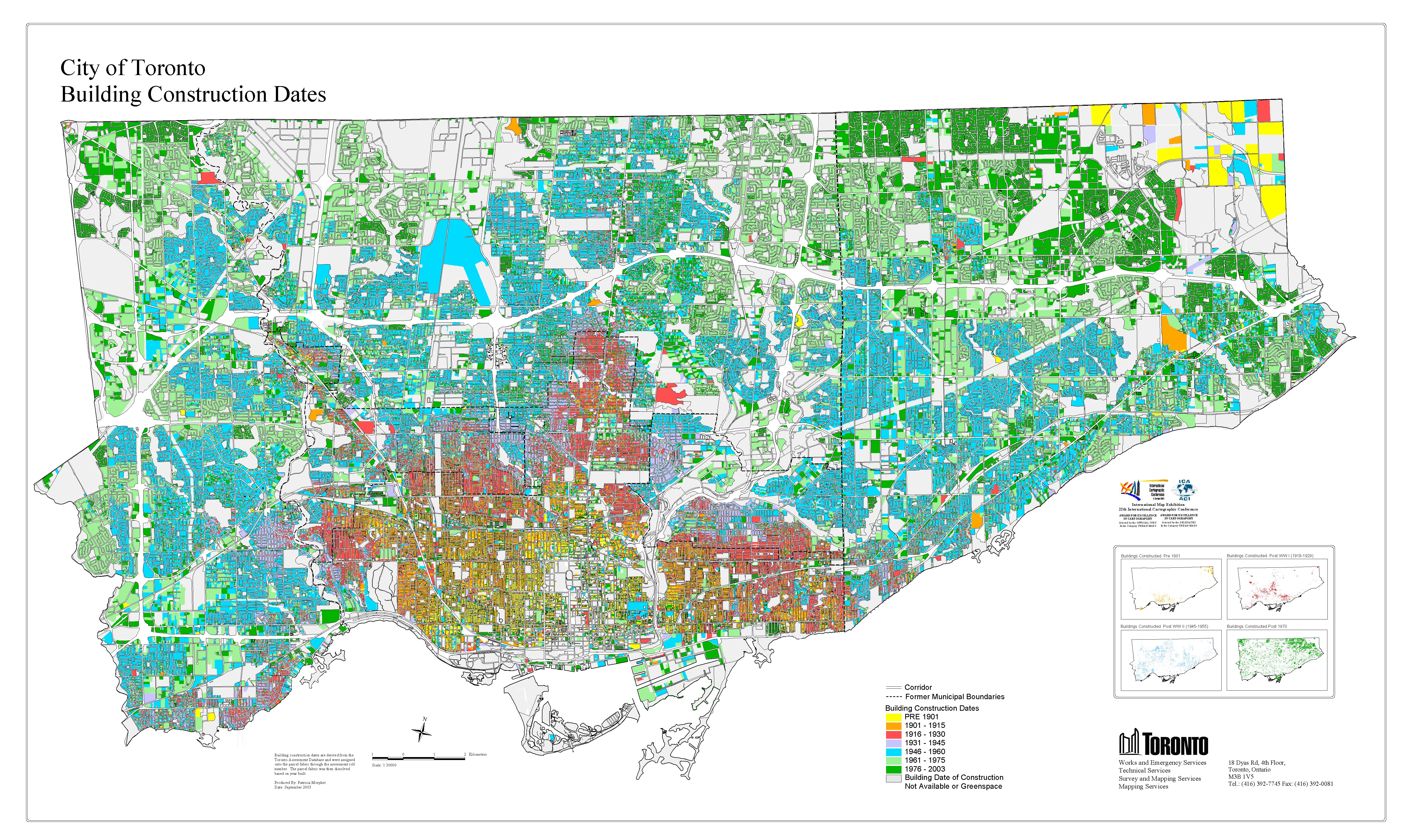
Here’s the final product – click to open it up in a larger, more-detailed size.
 What stories do these images tell? For some, personal ones. A larger version of this map hangs at the entrance to the research hall of the Toronto Archives, and you’ll often find one or two building researchers poring over it looking for their homes. It is an excellent starting point for that kind of research.
To me, the most striking fact of this map & video is the way they captures the changing shape of Toronto’s suburbs. During the early 1900s Toronto’s Victorian, lake-hugging core expanded rapidly west, north, and east, driven by demand for new housing and facilitated by an expanding streetcar network. Older industrial communities along the railway lines and previously isolated village communities were annexed and incorporated into the city. The orange and red constructions on this map capture that moment, which created streetcar suburbs like High Park or the Beaches, very well.
The post-1945 decades saw another wave of construction, this time facilitated by mass automobile ownership and an interventionist Metro government. Detached houses, public housing, and hundreds of apartment towers sprouted up on what had been farmland just a few years previously, in Etobicoke, Scarborough, and the other surrounding municipalities. Extensive (sub)urbanization beyond the city limits was complicating any notion of a traditional urbanism with a distinct centre and periphery. By the 1970s a sprawling, polycentric urban region was taking shape. Mapping built form is one way to follow Toronto’s long and fascinating transformation into the city we know today.

